Racing the Bike and Run Along Carlsbad Boulevard and the Coastal Roads
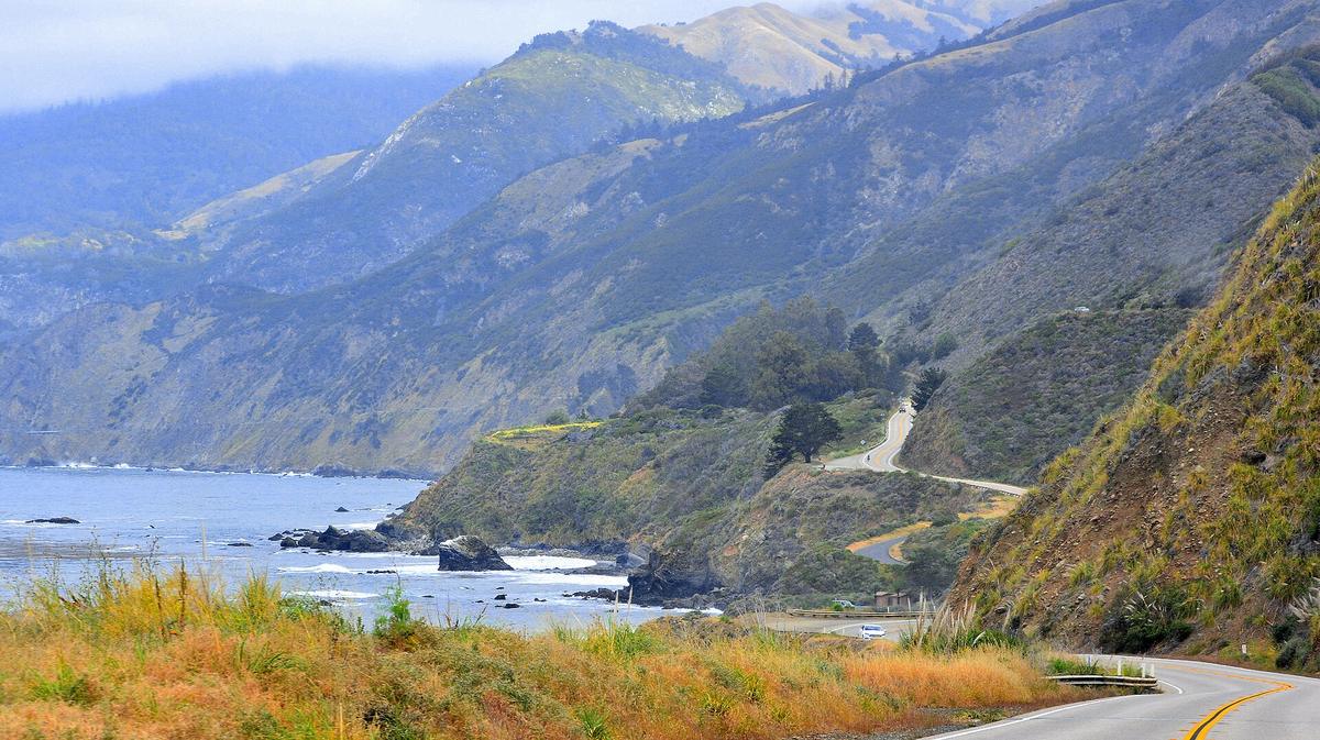
The Carlsbad triathlon bike and run course uses coastal roads that are generally flat, but sidewalk gaps along Highway 101 and incomplete rail trail sections can surprise runners.
.jpg)
The Bike Leg: Carlsbad Boulevard and the Coast Road
Traffic And Road Surface
Ride before 7:00am. Traffic on Coast Highway is low then but climbs to moderate or high on summer weekends after 8:00am. The surface is asphalt throughout. The course shape is a coastal out-and-back using Carlsbad Boulevard and surrounding streets, flat except for two short climbs.
The Two Climbs And The Wind
The northbound climb sits between Tamarack Avenue and Oceanside Boulevard. It runs roughly 0.4 miles with about 30 feet of elevation gain. The southbound climb, between Tamarack Avenue and Cannon Road, is roughly 0.3 miles with about 25 feet of gain. Neither climb is steep enough to force a gear change for most riders. The wind matters more than the gradient. The prevailing wind blows onshore from the west or west-northwest. Morning wind speeds range from 5 to 12 mph. Afternoon speeds climb to 10 to 18 mph as the marine layer burns off. The northbound view section from Pine Avenue to the Oceanside city limit gives you unobstructed ocean exposure. That means full wind exposure too. The southbound view section from Tamarack Avenue to Cerezo Drive runs along the bluffside with similar exposure.
Gearing And Course Changes
For a flatland-trained rider, a 53/39 chainring with an 11-25 cassette works. For a hill-trained rider, an 11-23 cassette is enough. The race organiser publishes the current year's course map and any changes on the official race site. The course is subject to alteration each year. Check it before you pack your bike.
The Run Leg: Seawall, Beach Path, and the Discontinuous Sidewalks
Surface And Shade
The run surface switches between concrete on the seawall and compacted sand and decomposed granite on the beach path. Both sections have zero elevation change and zero shade. The seawall runs from Tamarack Avenue to Pine Avenue. The beach path runs from Pine Avenue to the Warm Water Jetties parking lot. The sun exposure after the marine layer burns off is full and unshaded.
Marine Layer Timing
The marine layer blankets the coast from May through July most reliably, and variably in March, April, August, and September. Burn-off time ranges from 8:00am to 11:00am. If you race in June or July, expect the first hour of the run to be cool and overcast and the last hour to be bright. The real problem on the run is the discontinuous sidewalks along sections of Coast Highway 101.
Sidewalk Gaps And Pacing
The Coastal Rail Trail, which would link Carlsbad to Leucadia on a paved off-road path, is incomplete. Sections of sidewalk between Carlsbad and Leucadia are broken by gaps, driveways, and road crossings that force you onto the asphalt shoulder. Maps make the route look like a continuous beachfront path. It is not. Plan your race-day pacing knowing you will need to watch the surface shifts and stay alert for traffic crossing points.
Spectator Access, Logistics, and What Trips People Up
Where To Watch
Spectators can watch the bike leg northbound from the Carlsbad Boulevard sidewalk between Tamarack Avenue and Surfrider Way, and southbound from the sidewalk between Tamarack Avenue and Cannon Road. The run is visible from the seawall between Tamarack and Pine Avenue, and from the beach path between Pine Avenue and the Warm Water Jetties lot.
Parking Reality
Parking at Tamarack Beach on race morning is extremely tight. The nearest overflow lot at the Oceanside Civic Center fills by 6:30am. Tamarack Beach parking is metered and enforced aggressively from 8:00am, and the app-based payment system requires cell service, which is weak near the lifeguard tower. Do not rely on live tracking apps working during the race. Cell service on the beach itself is patchy, especially near the waterline. The Pronto app for transit ticketing requires a data connection to activate passes. Download it and set it up before arriving at the platform.
Trains, Rideshares And Sunday Dinner
The Coaster train does not run early enough on Sundays for a race start. The first southbound train arrives after 9:00am. If you are staying in Carlsbad Village and planning to use the train to get to the race site, that plan fails. Arrange a ride or a pre-booked rideshare. Rideshare wait times spike to 20 to 30 minutes when the race finishes. Do not assume you can walk or rely on rideshare between the race site, your hotel, and dinner without a plan. The coastal towns are spread across 15 miles. Many Carlsbad Village restaurants close by 8:00pm on Sundays, leaving limited post-race dinner options beyond pizza and fast casual. Plan your meal before 8:00pm or bring food back to your hotel.

What Goes Wrong Most Often
The single thing that trips up racers and their support crews is the disconnect between what the map shows and what the ground delivers. The Coastal Rail Trail is not finished, so the run route includes sections of discontinuous sidewalk that force you onto the shoulder of Coast Highway 101. The marine layer can sit on the coast until 11:00am, making the first hour of the run cool and damp even when inland temperatures are in the 80s, and then the sun hits hard on a route with zero shade. The cell service on the beach is unreliable for parking payment and tracking apps. The Coaster train does not run early enough on Sundays. The restaurants close early. And the course changes each year. None of these are reasons to skip the race. They are reasons to plan like the course is on public roads, the weather is coastal, and the infrastructure is still catching up to the event.
Read next
-
 Carlsbad Hotels What the Town Actually Has for Race Weekend
Carlsbad's hotels sorted for a triathlon weekend: Village walkability, La Costa resort recovery, and why Sunday late checkout matters for racers.
Carlsbad Hotels What the Town Actually Has for Race Weekend
Carlsbad's hotels sorted for a triathlon weekend: Village walkability, La Costa resort recovery, and why Sunday late checkout matters for racers.
-
 Where to Stay for the Carlsbad Triathlon Measured From Transition
Where to stay for the Carlsbad Triathlon, measured by walking or driving time to the Tamarack Beach transition area that opens before dawn.
Where to Stay for the Carlsbad Triathlon Measured From Transition
Where to stay for the Carlsbad Triathlon, measured by walking or driving time to the Tamarack Beach transition area that opens before dawn.
-
 What to Do in Carlsbad Around the Race That Is Not the Race
Low-key Carlsbad activities for the day before and after a triathlon: peacock-filled historic parks, pier walks, calm lagoon trails, and a small surf museum.
What to Do in Carlsbad Around the Race That Is Not the Race
Low-key Carlsbad activities for the day before and after a triathlon: peacock-filled historic parks, pier walks, calm lagoon trails, and a small surf museum.
-
 When the Carlsbad Race Falls and What the Coast Is Actually Like Then
When the Carlsbad triathlon typically falls, what the marine layer does to beach mornings in June, and which overlapping events make hotel rooms scarce and expensive.
When the Carlsbad Race Falls and What the Coast Is Actually Like Then
When the Carlsbad triathlon typically falls, what the marine layer does to beach mornings in June, and which overlapping events make hotel rooms scarce and expensive.
-
 Getting to Carlsbad and Around the Coastal Villages Without a Fuss
How to reach Carlsbad by train or car from San Diego airport, navigate the Pronto transit app, and park near Tamarack Beach on race morning without getting a ticket.
Getting to Carlsbad and Around the Coastal Villages Without a Fuss
How to reach Carlsbad by train or car from San Diego airport, navigate the Pronto transit app, and park near Tamarack Beach on race morning without getting a ticket.
-
 A Carlsbad Triathlon Weekend Hour by Hour and What to Do With the Rest
An hour-by-hour Carlsbad triathlon weekend plan: Friday arrival, Saturday packet pickup and shakeout, Sunday race morning through dinner, and Monday recovery before the trip home.
A Carlsbad Triathlon Weekend Hour by Hour and What to Do With the Rest
An hour-by-hour Carlsbad triathlon weekend plan: Friday arrival, Saturday packet pickup and shakeout, Sunday race morning through dinner, and Monday recovery before the trip home.
-
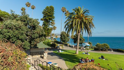 Tamarack Beach
Where the swim start and transition area sit at Tamarack Beach, why the parking meters are enforced from 8am, and which overflow lot fills before dawn on race morning.
Tamarack Beach
Where the swim start and transition area sit at Tamarack Beach, why the parking meters are enforced from 8am, and which overflow lot fills before dawn on race morning.
-
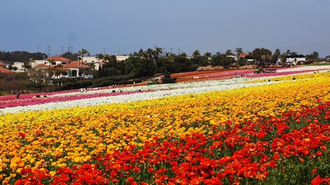 The Flower Fields
 at Carlsbad Ranch bloom March through May only. Whether they overlap with your race weekend and whether they are worth the advance tickets and drive time.
The Flower Fields
The Flower Fields at Carlsbad Ranch bloom March through May only. Whether they overlap with your race weekend and whether they are worth the advance tickets and drive time.
-
 Legoland California
 sits 10 minutes east of Tamarack Beach, opens at 10am, and is built for ages 2–12 — the ideal family reward after a Carlsbad triathlon weekend.
Legoland California
Legoland California sits 10 minutes east of Tamarack Beach, opens at 10am, and is built for ages 2–12 — the ideal family reward after a Carlsbad triathlon weekend.